
Understanding the Region's Geography
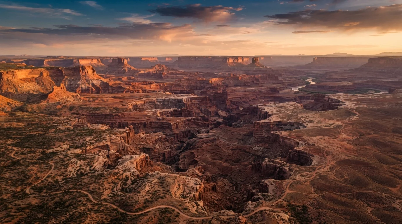
The American Southwest is not a single landscape - it's a collection of distinct geological zones spread across Arizona, Utah, Nevada, New Mexico, and parts of Colorado. The Colorado Plateau dominates the north and center, producing the canyon country that defines the region's iconic imagery: the Grand Canyon, Zion, Bryce Canyon, Arches, and Canyonlands. The Sonoran Desert stretches across southern Arizona and into California, home to saguaro cacti, Saguaro National Park, and the city of Tucson. The Mojave occupies southern Nevada and the California border, with Death Valley as its dramatic extreme.
This geographic diversity matters for planning because conditions, elevations, and access points vary dramatically within short distances. Bryce Canyon sits at roughly 8,000 feet elevation - cold enough for snow in May - while Lake Powell sits at 3,700 feet. Understanding which zone your destinations fall into helps you pack correctly, schedule activities at the right time of day, and avoid dangerous surprises.
277 miles
Length of the Grand Canyon
The Grand Canyon stretches 277 river miles end to end, illustrating the sheer scale visitors need to account for when planning access points.
5
States in the Southwest region
Arizona, Utah, Nevada, New Mexico, and Colorado collectively form what most travel planners consider the American Southwest.
4+ hours
Typical drive between major park clusters
Many popular park pairings - such as Arches to Zion - involve drives exceeding four hours, making daily logistics planning essential.
For readers new to structuring a multi-stop journey, the anatomy of a well-built travel itinerary explains how to organize legs of a trip so geography - not just desire - drives the sequence.
Timing Your Visit: Heat, Crowds, and Shoulder Seasons
Timing is the single most consequential planning decision you'll make for a Southwest trip. Summer (June through August) brings dangerous heat to lower-elevation sites. The floor of the Grand Canyon regularly exceeds 110°F; the National Park Service suspends strenuous hiking below the rim during midday hours in summer for this reason. Death Valley's all-time recorded temperature record stands above 130°F. These aren't abstractions - heat illness hospitalizations spike at Southwest parks every summer.
Summer Heat Is a Genuine Safety Risk
At low-elevation sites like the Grand Canyon's inner gorge, Zion Narrows, and Death Valley, summer temperatures can reach or exceed 110-120°F. Heat exhaustion and heat stroke can develop rapidly, even in physically fit adults. The National Park Service advises against strenuous daytime hikes below the Grand Canyon rim between May and September. Always verify current heat advisories on each park's official website before planning your days.
Spring (mid-March through May) and fall (September through early November) are widely regarded as the most practical windows. Temperatures at most canyon and desert sites sit in the 60s-80s°F range, trail conditions are stable, and wildflower blooms add visual interest in March and April. Crowds peak at spring break and fall long weekends, but the conditions are far safer and more comfortable than midsummer.
Winter is underrated for certain sites. Zion Canyon sees dramatically fewer visitors between December and February, and snow on red rock creates distinctive scenery. Higher-elevation parks like Bryce Canyon have groomed snowshoe trails. However, some roads and visitor facilities close seasonally - always verify current conditions with the National Park Service before travel.
For a deeper framework on how seasons and local events should influence when you go, see planning around seasons, crowds, and local events.
Standout Destinations Worth Your Time
The Southwest has dozens of parks and monuments. These are the destinations that consistently reward visitors with experiences that feel genuinely irreplaceable - not just photogenic, but spatially and culturally distinct.
- Grand Canyon National Park (Arizona): The South Rim is accessible year-round and offers both rim walks and permit-required inner-canyon hikes. The North Rim, open mid-May through mid-October, has far fewer visitors and a dramatically different character.
- Zion National Park (Utah): The Narrows (a slot canyon hike through the Virgin River) and Angels Landing (requires a permit lottery) are the signature experiences. The park operates a mandatory shuttle system - private vehicles cannot access the main canyon road.
- Bryce Canyon National Park (Utah): Hoodoos - tall thin spires of eroded rock - fill the amphitheaters in dense formations unlike anywhere else in the region. Sunrise and sunset light transforms the colors dramatically.
- Arches and Canyonlands (Utah): These two parks share a geographic area near Moab. Arches is compact and heavily visited; Canyonlands is vast and requires more planning but offers genuine solitude in its Island in the Sky district.
- Monument Valley (Arizona/Utah border): Administered by the Navajo Nation, not the National Park Service. Access and touring protocols differ - check the Navajo Parks and Recreation official site for current entry requirements.
- White Sands National Park (New Mexico): A visually singular landscape of white gypsum dunes. Compact enough to combine with nearby sites in southern New Mexico and El Paso.
At any site managed by tribal nations - such as Monument Valley or Antelope Canyon - book guided access directly through the official tribal tourism authority, not third-party resellers. Protocols and permitted activities differ from NPS sites.
Tribal-managed sites have specific access rules that third-party booking platforms don't always accurately represent, and booking directly ensures compliance and supports the communities that manage these lands.
For any rim-to-river hike at the Grand Canyon, plan your hardest elevation gain for the first hours of morning and be off exposed trails before 10 a.m. during warm months.
Inner canyon temperatures rise sharply by mid-morning; rangers consistently identify late starts as the primary factor in heat-related rescues on the Bright Angel and South Kaibab trails.
Logistics: Distances, Driving, and Base Camps
The most common Southwest planning mistake is underestimating drive times. On a standard map, Zion and the Grand Canyon look close - the drive between the South Rim and Zion's main entrance is roughly 2.5 to 3 hours under normal conditions. Zion to Bryce Canyon adds another 1.5 hours. Arches to Zion is over 4 hours. These distances compound quickly if you're trying to cover multiple parks in a short window.
The practical solution is the base camp model: anchor in a hub town for two to three nights and radiate out to nearby parks, rather than moving lodging every day. Common base camps include:
- Moab, Utah - for Arches, Canyonlands, and Dead Horse Point State Park
- Springdale, Utah - immediately outside Zion's south entrance
- Kanab, Utah - a geographic midpoint between Zion, Bryce, and the North Rim
- Flagstaff, Arizona - a higher-elevation city (6,900 ft) that serves as a cooler base for Grand Canyon South Rim day trips
A rental car is non-negotiable unless you're joining an organized tour. No rail or meaningful intercity bus service connects these parks. Factor fuel costs and long drive times into your daily planning - a day that includes a four-hour drive leaves limited time for actual hiking.
If you're approaching this trip without prior experience structuring complex itineraries, the first-timer's trip planning roadmap walks through how to build a multi-destination plan step by step.
Practical Preparation Before You Go
Several preparation steps are specific to the Southwest and easy to overlook until it's too late.
Permits and Reservations
Many of the region's most-visited experiences now require advance permits. Angels Landing in Zion, the Wave in Vermilion Cliffs, and Havasupai Falls (a permit-only tribal land in Arizona) all use lottery or reservation systems that fill months out. Check each site's official management authority - the National Park Service, BLM, or relevant tribal parks office - well before your travel dates.
Water and Dehydration Risk
Desert air is dry; sweat evaporates so quickly that thirst often lags behind actual dehydration. Standard guidance from park rangers is to carry and drink at least one liter of water per hour of hiking in warm conditions. Many trailheads have potable water stations, but some remote sites do not - verify before you leave the trailhead.
Cell Service Gaps
Cell coverage is unreliable across large portions of the Colorado Plateau and rural desert areas. Download offline maps (the NPS app and several navigation apps support this) and carry a paper map for any back-road driving. If you plan to hike remotely, inform someone of your route and expected return time.
Download Offline Maps Before You Leave a Town
Cell coverage disappears quickly outside Southwest hub towns. Before driving into canyon country or remote desert roads, download the relevant area for offline use in your navigation app and the NPS app. Some routes - particularly on the Arizona Strip between the North Rim and Zion - have stretches with no signal for an hour or more.
The Southwest rewards deliberate preparation. The travelers who struggle most are those who arrived with a list of highlights but no logic connecting them. If you want to pressure-test your planning assumptions before you go, common trip-planning beliefs examined is a useful calibration read.